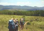

Your first overnight in the backcountry shouldn’t feel like a survival test. I’ve watched too many friends attempt some grueling 20-mile sufferfest for their inaugural backpacking trip, only to swear off the whole endeavor forever. That’s backwards. The point is to fall in love with sleeping under the stars, waking up to birdsong, and realizing you actually can carry everything you need on your back.
The best beginner backpacking trails in national parks share a few key traits: manageable distances, clearly marked paths, reliable water sources, and established campsites where you don’t have to stress about finding a flat spot at dusk. These trails let you focus on the experience rather than constantly consulting your map or wondering if you’re about to run out of water.
I’ve put together eight trails across the country that hit that sweet spot — challenging enough to feel like an accomplishment, but forgiving enough that you won’t be limping back to your car questioning all your life choices. Whether you’re on the East Coast, out West, or somewhere in between, there’s a first-time backpacking national park adventure waiting for you.
What Makes a Trail Beginner-Friendly
Not all “easy” trails are actually good for first-time backpackers. A flat 15-mile death march through featureless terrain is technically easy, but it’ll crush your soul. Here’s what I actually look for:
Distance under 10 miles total. Your first overnight doesn’t need to prove anything. Four to eight miles in, a night under the stars, four to eight miles out. That’s plenty.
Established campsites with water. Designated sites mean you’re not bushwhacking at 7 PM trying to find level ground. Water nearby means you’re not rationing every sip.
Bail-out options. Can you turn around if weather rolls in or your knee starts screaming? The best beginner trails don’t commit you to a point of no return.
| Characteristic | Why It Matters |
|---|---|
| Under 2,000 ft elevation gain | Your legs will thank you on day two |
| Well-marked trail | No GPS skills required |
| Permit availability | Some trails book out months ahead |
| Shelter or flat sites | Sleep actually matters |
One more thing: don’t pick a trail just because it photographs well for Instagram. That stunning ridge walk might also have zero water, insane exposure, and require you to carry crampons. Save the ambitious stuff for trip three or four.
1. Bright Angel Trail to Havasupai Gardens — Grand Canyon
The Grand Canyon is one of those bucket-list destinations that can actually work for beginners — if you pick the right route. The Bright Angel Trail to Havasupai Gardens (formerly called Indian Garden) is the classic intro to canyon backpacking.
Here’s what makes it work: you’re descending into the canyon on day one, which means the hard part (climbing out) comes when your pack is lighter. The trail is impeccably maintained — we’re talking switchbacks carved into the rock, handrails in spots, and rest houses with water along the way. It’s steep, no question, but the 4.6 miles to Havasupai Gardens are broken up nicely.
The campground itself sits in an honest-to-god oasis. Cottonwood trees, a creek, actual shade — it feels impossible after hiking through all that red rock. There are composting toilets, a ranger station, and treated water available. You can spend the afternoon wandering out to Plateau Point for views of the Colorado River 1,300 feet below, then crash early knowing tomorrow’s climb is the real workout.
Pro tip: Start your hike before dawn. Not just for temperatures (though that matters hugely in summer), but because the morning light in the canyon is genuinely unreal. You’ll want those photos.
The permit situation is the catch. Havasupai Gardens is one of the most requested backcountry sites in the entire national park system — roughly 75% of permit applications get denied. Apply exactly four months before your start date, have backup dates ready, and consider less popular shoulder season windows like late October or early March.
Trail Stats and Permit Info
- Distance: 9.2 miles round trip
- Elevation change: 3,040 feet (down then up)
- Campsite: Havasupai Gardens Campground (15 sites)
- Water: Yes, treated water available at campground
- Permit: Required, $10 plus $8/night, apply through Recreation.gov
- Best season: March-May, September-November (summer is dangerously hot)
2. Mineral King to Mosquito Lakes — Sequoia
If the Grand Canyon feels too exposed and desert-y for your taste, the Sierra Nevada offers a completely different vibe. The Mosquito Lakes trail out of Mineral King drops you into classic High Sierra terrain: granite bowls, alpine lakes, meadows exploding with wildflowers in July.
The hike itself covers about 7 miles round trip to the first lake, gaining around 2,000 feet of elevation. That’s on the steeper side for beginners, but the payoff is enormous. Mosquito Lake #1 sits at 9,000 feet surrounded by red fir forest, and if you’re feeling ambitious, use trails continue up to four more lakes tucked into increasingly dramatic basins below Hengst Peak.
Fair warning: the name isn’t false advertising. Mosquitoes at the lower lake can be brutal in early summer. Bring a head net or plan your trip for late August when the bugs have died down. Also, this is bear country — hard-sided bear canisters are required, no exceptions.
The drive to Mineral King deserves mention too. It’s 25 miles of narrow, winding road with hundreds of switchbacks. Not dangerous, just slow. Budget at least 90 minutes from Three Rivers and don’t try it after dark your first time.
One more thing: The marmots here are infamous. They will chew through brake lines, radiator hoses, anything rubber or plastic under your car. Wrap your vehicle in chicken wire or a tarp — I’m not kidding. The parking lot looks hilarious with all the car-burritos, but it beats a tow truck bill.
Trail Stats and Permit Info
- Distance: 7.2 miles round trip (to Lake #1)
- Elevation gain: 2,027 feet
- Campsite: Dispersed camping at lake
- Water: Yes, from the lakes (filter required)
- Permit: Required, walk-up permits often available, no lottery for Mineral King
- Best season: July-September (road typically opens late May)
3. Jones Run to Doyles River Loop — Shenandoah
Shenandoah doesn’t get enough credit as a backpacking destination. Everyone thinks of Skyline Drive and overlooks, but the park has nearly 80,000 acres of designated wilderness crisscrossed by 500 miles of trail. For East Coasters, it’s also significantly more accessible than schlepping out West.
The Jones Run/Doyles River loop works beautifully as a one-night intro trip. Starting from the parking area at mile marker 84, you’ll drop down through hardwood forest along Jones Run, passing a gorgeous 42-foot waterfall that makes an excellent lunch spot. The confluence of Jones Run and Doyles River is prime camping territory — flat spots along the water, established sites, and that soundtrack of rushing water all night.
Day two takes you back up Doyles River Trail, hitting another waterfall en route, before connecting to the Appalachian Trail for the final push back to your car. The full loop runs about 8 miles with roughly 2,300 feet of total elevation change.
What I appreciate about Shenandoah: the permit system is straightforward ($9 per person), campfires aren’t allowed (so less to pack), and the forest canopy provides natural shade even in summer. Plus, if anything goes wrong, you’re never more than a few miles from Skyline Drive.
Heads up: You can’t camp within 50 yards of trails or other campers, 100 yards from any structure, or in certain popular areas like Whiteoak Canyon. The dispersed camping rules give you freedom but require actually reading the regulations first.
Trail Stats and Permit Info
- Distance: 8.3 miles loop
- Elevation gain: ~2,300 feet total
- Campsite: Dispersed camping along lower creek sections
- Water: Multiple stream crossings (filter required)
- Permit: Required, $9/person plus $6 reservation fee via Recreation.gov
- Best season: April-June, September-October
4. Backcountry Island Camping — Voyageurs
Voyageurs is the wild card on this list. There’s no trail, really. Instead, you’re paddling or motoring across enormous lakes to camp on islands scattered across the Minnesota-Canada border.
That sounds intimidating, but here’s why it actually works for beginners: the park provides canoes at interior backcountry sites, which you unlock with a combination code on your permit. So you can hire a water taxi to drop you at a trailhead on the Kabetogama Peninsula, hike a few miles to your campsite, and use the park’s boats to explore interior lakes. Or skip the hiking entirely and get dropped directly at a boat-in site on one of the big lakes.
The campsites themselves are well-established — tent pads, fire rings, bear lockers, pit toilets. You’re not roughing it in the traditional sense. What you are doing is experiencing true North Woods solitude: loons calling at dusk, northern lights overhead, mornings so quiet you can hear fish jumping.
The primitive hike-in sites (Red Pine and Blueberry Ridge) along the Kab-Ash Trail are the only ones that don’t require watercraft. These make excellent first-timer destinations since you can reach them entirely on foot.
Cost reality check: This trip will be pricier than most. Water taxi services run $100-200 depending on distance. If you have your own boat or canoe, the math changes completely. Either way, the experience is unlike anything else in the national park system.
Trail Stats and Permit Info
- Distance: Varies (hike-in primitive sites are 2-4 miles in)
- Elevation gain: Minimal (it’s Minnesota)
- Campsite: 14 backcountry sites, 2 primitive hike-in sites
- Water: Lake water everywhere (filter required)
- Permit: Required, $25-35/night via Recreation.gov
- Best season: June-September (winters are brutal)
5. Kephart Prong Trail to Kephart Shelter — Great Smoky Mountains
The Smokies have over 800 miles of trail and dozens of backcountry campsites and shelters. Picking one for your first trip can feel overwhelming. But Kephart Shelter checks every box for beginners, and the approach via Kephart Prong Trail adds some genuine history to the hike.
It’s only 2 miles in, gaining just 950 feet along an old jeep road. Ten minutes from the trailhead, you’ll pass the ruins of a Civilian Conservation Corps camp from the 1930s — stone walls, chimney remnants, the works. Five log bridges cross various tributaries of Kephart Prong, keeping your feet dry and adding some visual interest to the walk.
The shelter itself sits at 3,600 feet and sleeps about a dozen people. It’s one of only two shelters in the park below 4,000 feet, which means milder temperatures than the high-elevation options on the Appalachian Trail. The short approach makes this ideal for families with older kids or anyone nervous about biting off too much.
Budget win: Great Smoky Mountains has some of the most affordable backcountry permits in the system. Shelters run just $4 per person per night, with a maximum charge of $20 per person for longer trips. Compare that to $30+ nights elsewhere.
One thing to know: Kephart Shelter connects to the Sweat Heifer and Grassy Branch trails, which climb to the AT. If day two goes smoothly and you’re feeling strong, you can extend your trip. But there’s zero shame in hiking out the same way you came in.
Trail Stats and Permit Info
- Distance: 4.2 miles round trip
- Elevation gain: 950 feet
- Campsite: Kephart Shelter (three-sided, sleeps 12)
- Water: Kephart Prong stream nearby (filter required)
- Permit: Required, $4/person/night for shelters, reserve at smokiespermits.nps.gov
- Best season: April-October
6. Thunder Creek Trail — North Cascades
North Cascades is criminally underrated. It sees a fraction of the visitors of neighboring parks but delivers jaw-dropping alpine scenery — glaciers, turquoise lakes, peaks that look like someone Photoshopped them.
Thunder Creek Trail is the gateway drug. Starting from Colonial Creek Campground on the shores of Lake Diablo, the path parallels Thunder Creek through old-growth forest with basically zero elevation gain for the first few miles. A suspension bridge at mile 2 makes a decent turnaround point for day hikers, but backpackers continue south to a string of established camps.
Thunder Camp sits just 1.5 miles in and works perfectly for a family overnight. Neve Camp, about 3 miles further, offers more seclusion with space for five tents. Both have pit toilets and flat spots already cleared — no searching for somewhere to pitch your tent.
The trail continues 38 miles to Park Creek Pass, but that’s multi-day territory. For beginners, an out-and-back to Neve Camp (roughly 9 miles round trip) delivers all the North Cascades magic without the commitment.
Permit heads-up: Unlike some crowded parks, North Cascades still offers free backcountry permits. Stop at the Wilderness Information Center in Marblemount the morning of your hike. Walk-ups are usually available outside of holiday weekends, though a $10 reservation fee applies if you book ahead.
Trail Stats and Permit Info
- Distance: 3-9 miles round trip (depending on camp choice)
- Elevation gain: Minimal to Thunder/Neve camps
- Campsite: Thunder Camp, Neve Camp (dispersed sites with privy)
- Water: Thunder Creek (filter required)
- Permit: Required, free (optional $10 reservation fee)
- Best season: June-October (varies by snowpack)
7. Glacier Gorge Trail — Rocky Mountain
Glacier Gorge in Rocky Mountain National Park is legitimately one of the hardest backcountry permits to get in the entire country. The single wilderness campsite, tucked between Mills Lake and Black Lake, sells out within minutes of the March 1st reservation window opening.
But here’s why I’m including it anyway: if you manage to snag a spot, it’s an almost perfect beginner trip. The trail covers 3.8 miles each way with only 760 feet of elevation gain. You pass Alberta Falls at mile 0.8 (stop and gawk), continue through subalpine forest, then emerge at Mills Lake with Longs Peak looming overhead. The campsite sits just past the lake in a glacially-carved basin that feels genuinely primordial.
The catch beyond permit difficulty: this is a pack-it-all-out zone. WAG bags are required for all solid human waste — no cat holes allowed. The high alpine environment is too fragile. If that sounds unpleasant, know that the system works and keeps these areas pristine for everyone.
My advice for permits: have backup options ready. Timber Lake, Sandbeach Lake, and several other designated sites offer similar mileage with better availability. The Glacier Gorge campsite is special, but it’s not the only way to experience Rocky’s backcountry.
Trail Stats and Permit Info
- Distance: 7.6 miles round trip
- Elevation gain: 760 feet
- Campsite: Glacier Gorge (single site)
- Water: Glacier Creek and Mills Lake (filter required)
- Permit: Required, $30 reservation fee, reservations open March 1 on Recreation.gov
- Best season: June-September (snow lingers at elevation)
- Special requirement: WAG bags mandatory for human waste
8. Slough Creek Trail — Yellowstone
Yellowstone’s backcountry doesn’t require dealing with crowds at Old Faithful or traffic jams at Lamar Valley. Slough Creek Trail offers a gentler pace: meadows, meandering water, and legitimately world-class trout fishing.
The trail starts with a short, steep climb — nothing terrible, maybe 400 feet in the first mile — then drops into expansive meadows along Slough Creek. The first backcountry campsite sits 4.3 miles in, with additional sites spaced further north toward the Absaroka-Beartooth Wilderness boundary.
What sets Slough Creek apart is the vibe. It’s quieter than the geyser basins, less dramatic than the canyon, but there’s a pastoral beauty that feels almost European. Wildflowers in summer. Elk and bison grazing. Cutthroat trout rising in the evening.
Wildlife warning applies: this is grizzly country. Bear canisters are required, and the park mandates watching a 15-minute safety video before picking up your permit. Sleep 100 yards from your food storage area. Make noise on the trail. Know how to use bear spray. These aren’t suggestions.
Fishing bonus: Slough Creek is catch-and-release only and considered some of the best native cutthroat water in the lower 48. If you’ve ever wanted to combine backpacking with fly fishing, this is your trail.
Trail Stats and Permit Info
- Distance: 8.6 miles round trip (to first campsite)
- Elevation gain: ~600 feet
- Campsite: Multiple designated sites with bear boxes
- Water: Slough Creek (filter required)
- Permit: Required, reserve via Recreation.gov starting April 26; lottery for peak dates
- Best season: June-September (trail access depends on road opening)
How to Choose Your First Overnight Trail
Eight options feels like a lot. Here’s how to narrow it down.
Start with geography. Don’t fly across the country for your first trip. Something goes wrong — forgotten gear, unexpected weather, twisted ankle — and you want to be reasonably close to home. Build skills locally before planning the big destination trips.
Match terrain to your fitness. Grand Canyon’s 3,000-foot descent-then-climb is very different from Thunder Creek’s flat forest amble. Be honest about where you are physically. There’s no glory in suffering through something too hard.
Consider time of year. Many of these trails are only accessible a few months annually. Mineral King’s road doesn’t open until late May. Yellowstone’s northern roads can stay closed until June. High alpine routes may have lingering snow into July.
Factor in permits. If you’re planning just a few weeks out, Glacier Gorge isn’t happening. But North Cascades walk-up permits or Sequoia’s non-lottery system might work perfectly. Check availability before falling in love with a specific trail.
| If you want… | Try this |
|---|---|
| Iconic scenery, tough permits | Grand Canyon, Rocky Mountain |
| East Coast accessibility | Shenandoah, Great Smokies |
| Alpine lakes | Sequoia, North Cascades |
| Solitude and water | Voyageurs, Yellowstone |
And honestly? Your first trip doesn’t have to be special. It just has to happen. A forgettable trail three hours from home still teaches you how to pack, how to sleep on the ground, how much water you actually drink. Those lessons transfer everywhere.
Essential Gear Checklist for Your First Trip
Don’t overthink this. The ten essentials have been published for decades, and they still apply. But here’s what actually matters for a one-night beginner trip:
Shelter system
- Tent (freestanding is easier; don’t buy cheap)
- Ground cloth or footprint
- Sleeping bag rated to expected lows
- Sleeping pad (R-value matters in shoulder seasons)
Clothing
- Layers you can mix and match
- Rain shell (trust me)
- Extra socks
- Warm hat regardless of season
Food and water
- Filter or chemical treatment (don’t drink untreated backcountry water)
- Water bottles or reservoir (2-3 liters capacity)
- Stove and fuel if cooking hot meals
- Food in bear canister where required
Navigation and safety
- Map of the area
- Headlamp with fresh batteries
- First aid kit (basic is fine)
- Emergency shelter or bivy
The stuff you’ll forget
- Toilet paper and trowel (or WAG bags where required)
- Sunscreen
- Bug spray
- Blister supplies
One piece of actual advice: rent or borrow expensive gear before buying. Most outdoor retailers offer rental programs. REI’s used gear section sells returned items at significant discounts. Finding out you hate your pack’s hip belt is better when you haven’t dropped $300 on it.
Frequently Asked Questions
Do I need a permit for every national park overnight trip?
Yes. Every national park requires a backcountry permit for overnight stays. The systems vary wildly — some are free, some cost money, some require lotteries months in advance, some are walk-up only. Check the specific park’s website before planning.
How far in advance should I reserve permits?
It depends entirely on the trail. Grand Canyon’s popular routes require applying four months ahead. Rocky Mountain’s lottery opens March 1 for the entire summer season. Shenandoah and North Cascades often have walk-up availability. Research your target trail specifically.
What if I’ve never camped anywhere before?
Consider a night at a frontcountry campground first. You’ll figure out how to set up your tent, what you actually need for dinner, how you sleep on a pad — all with your car nearby if something goes wrong. Then graduate to an easy backpacking trail.
Is it safe to go backpacking alone?
People do it all the time. That said, your first few trips benefit enormously from having a partner who can help troubleshoot problems. Even an equally inexperienced friend doubles your problem-solving capacity and provides backup if something goes wrong.
What’s the single most important piece of gear for beginners?
Proper footwear. Blisters will ruin any trip faster than missing almost any other item. Get boots or trail runners that fit your feet, break them in before the trail, and carry moleskin or Leukotape just in case.
Final Thoughts
The best beginner backpacking trails share one quality: they let you focus on the experience instead of the logistics. Pick something manageable. Don’t try to impress anyone. Get out there, make some mistakes in a low-stakes environment, and figure out whether this whole sleeping-in-the-woods thing is for you.
My recommendation if you’re truly starting from zero? Great Smoky Mountains. The Kephart Shelter trip is short, affordable, and the permit system isn’t nightmarish. East Coasters have easy access. The CCC ruins add historical interest. And if you love it, the park has hundreds more miles to explore.
But honestly, any of these eight trails will give you a proper introduction. The important part is taking that first step off the pavement and into the backcountry. Everything else — better gear, bigger miles, harder routes — comes later. For now, just go.
Featured Image Source: Pexels