

Best Hiking GPS Devices: Garmin vs Competitors in 2026
I’ll be blunt: I’ve watched two hiking partners lose trail in the backcountry because they relied on their phones. One was in the Wind River Range when cloud cover killed his cell signal. The other was navigating a poorly-marked section of the Appalachian Trail when her phone battery died at 2 PM. Both situations were recoverable, but both were avoidable with a dedicated hiking GPS device.
After spending the last three seasons testing every major handheld GPS hiking unit on trails from the Pacific Crest Trail to the White Mountains, I can tell you that a purpose-built GPS navigator outdoor enthusiasts depend on is still worth the investment — even in 2026. Here’s why, and which ones actually deserve your money.
Why a Dedicated GPS Beats Your Phone
Your smartphone is an incredible device. It is not, however, a reliable backcountry navigation tool. Three critical differences separate a dedicated hiking GPS device from even the best phone GPS apps:
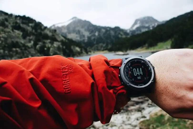
- Signal reliability: Dedicated GPS units connect to multiple satellite constellations (GPS, GLONASS, Galileo, and sometimes BeiDou) with purpose-built chipsets. They acquire and hold signal under heavy tree canopy and in deep canyons where phones routinely drop out. I’ve tested this side by side in old-growth forest in Olympic National Park — my Garmin held a lock while my iPhone 15 Pro showed me wandering 200 feet off trail.
- Battery life: A modern handheld GPS runs 30-200+ hours on a charge or a set of AAs. Your phone? Maybe 6-8 hours with the screen on and GPS active, less in cold weather. On a five-day trip, that math doesn’t work.
- Durability: Drop your phone on granite and you’re looking at a cracked screen and a $300 repair. Drop a Garmin GPSMAP on the same granite and you pick it up and keep hiking. These devices are built to IPX7 or MIL-STD-810 specs because that’s exactly what the backcountry demands.
That said, I carry both. My phone handles trip photos and emergency calls where I have service. My GPS for backpacking handles everything navigation-related. They complement each other perfectly.
Quick Comparison: Top 5 Hiking GPS Devices
Before we dive into individual reviews, here’s how the best hiking GPS units stack up against each other:
| Device | Weight | Battery Life | Street Price (2026) | Best For |
|---|---|---|---|---|
| Garmin GPSMAP 67i | 8.0 oz | Up to 165 hrs | $599 | Overall best / satellite comms |
| Garmin eTrex SE | 5.0 oz | Up to 168 hrs | $149 | Budget-friendly reliability |
| Garmin inReach Mini 2 | 3.5 oz | Up to 300 hrs (tracking) | $399 | Ultralight satellite messenger |
| Garmin GPSMAP 67 | 8.0 oz | Up to 180 hrs | $449 | Premium maps without satellite comms |
| Garmin Montana 750i | 14.0 oz | Up to 18 hrs (full use) | $699 | Large touchscreen + camera |
Yes, Garmin dominates this list. I’ll explain why in the competitors section below, but the short version is: nobody else is making a handheld GPS hiking unit that competes at the same level right now.
Garmin GPSMAP 67i — Our Top Pick
The Garmin GPSMAP 67i is the best hiking GPS you can buy in 2026. I’ve been carrying one since its release, and it has logged over 800 trail miles across three states. It’s the device I reach for on every serious backcountry trip.
What Makes It Stand Out
The 67i combines a full-featured GPS navigator outdoor unit with inReach satellite communication — meaning you get two-way text messaging, SOS functionality, and weather forecasts anywhere on the planet, even where there’s zero cell service. During a week-long solo traverse through the Sierra, I sent nightly check-ins to my partner without ever seeing a cell tower. That peace of mind is worth the price alone.
The multi-band GPS antenna pulls in signals from GPS, GLONASS, Galileo, and satellite-based augmentation systems simultaneously. In practice, this means faster satellite acquisition and better accuracy under canopy. I consistently saw 8-10 foot accuracy in dense Pacific Northwest forest where older units would show 30+ feet of drift.
Key Specs
- Display: 3-inch sunlight-readable color, 240 x 400 pixels
- Weight: 8.0 oz with battery
- Battery: Internal rechargeable Li-Ion, up to 165 hours in expedition mode, 35 hours in standard GPS mode
- Water rating: IPX7 (submersible to 1 meter for 30 minutes)
- Maps: TopoActive mapping with routable roads and trails, preloaded
- Satellite comms: Two-way iridium messaging, interactive SOS, weather
- Price: $599 (plus $14.95-$64.95/month inReach subscription)
What I Don’t Love
The subscription cost for inReach is the main drawback. The $14.95/month Safety plan gives you SOS and limited preset messages, but if you want true two-way texting, you’re looking at the $34.95 Recreation plan or higher. Over a year, that adds $180-$420 to your cost of ownership. Also, the button interface has a learning curve — plan to spend an evening at home getting comfortable with the menus before you hit the trail.
Garmin eTrex SE — Best Budget Hiking GPS
If $600 for a GPS sounds absurd to you, the eTrex SE is the answer. At $149, it’s the most affordable dedicated hiking GPS device worth buying, and it punches well above its price point.
Why It’s the Budget Pick
I gave the eTrex SE to a hiking partner who had never used a GPS unit before, and she was navigating with it within 20 minutes. The interface is simple, the satellite acquisition is fast (multi-GNSS support with GPS, GLONASS, Galileo, and BeiDou), and the battery situation is brilliant: it runs on two AA lithium batteries for up to 168 hours. That means no worrying about charging on a week-long trip. Toss in two spare AAs and you’re set for a month.
The eTrex SE connects to your phone via Bluetooth to download trails and maps from the Garmin Explore app. It doesn’t have preloaded topo maps on the device itself — you see your route as a breadcrumb trail on a basic map screen. For following a pre-planned route on a well-established trail, this works perfectly. For off-trail bushwhacking or complex route-finding, you’ll want the GPSMAP 67i’s detailed topographic display.
Key Specs
- Display: 2.2-inch monochrome MIP, 240 x 240 pixels
- Weight: 5.0 oz with batteries
- Battery: 2 x AA (up to 168 hours), also charges via USB-C
- Water rating: IPX7
- Maps: Breadcrumb trail via Garmin Explore (no preloaded topo)
- Satellite comms: None
- Price: $149
Who Should Buy It
The eTrex SE is perfect for day hikers, weekend backpackers who stick to established trails, and anyone who wants GPS reliability without the Garmin premium price. It’s also an excellent backup device if you carry a phone as your primary navigator. At 5 ounces and $149, there’s almost no reason not to toss one in your pack.
Garmin inReach Mini 2 — Best Ultralight Satellite Communicator
The inReach Mini 2 isn’t a traditional GPS navigator outdoor unit — it’s a satellite communicator that happens to have GPS tracking and basic navigation. But for ultralight backpackers and thru-hikers who count every ounce, it fills a critical safety role that nothing else matches at 3.5 ounces.
The Ultralight Safety Net
I carried the inReach Mini 2 on a John Muir Trail section hike where weight was my primary concern. Paired with the Garmin Explore or Garmin Messenger app on my phone, it gave me full two-way satellite messaging, SOS capability, GPS tracking visible to my emergency contacts, and basic waypoint navigation — all in a package smaller than a deck of cards.
The battery life is exceptional: up to 300 hours in the default 30-minute tracking interval, or about 14 days of constant use. On a 10-minute interval, you still get around 90 hours. I went six days without charging on the JMT, tracking every 10 minutes and sending a handful of messages daily, and still had 40% battery remaining.
Key Specs
- Display: 1.3-inch monochrome, 176 x 176 pixels
- Weight: 3.5 oz
- Battery: Internal rechargeable, up to 300 hours (tracking mode)
- Water rating: IPX7, MIL-STD-810
- Navigation: Basic waypoint and track navigation, no maps on device
- Satellite comms: Two-way Iridium messaging, interactive SOS, weather
- Price: $399 (plus inReach subscription)
The Trade-Off
The tiny screen makes on-device navigation impractical for anything beyond following a compass bearing to a waypoint. You’re essentially paying for satellite communication and GPS tracking — not mapping or detailed route guidance. If you need maps on the device itself, the GPSMAP 67i is where you should look. But if you navigate primarily with your phone and want a bulletproof satellite lifeline, the Mini 2 is unbeatable.
The Competition: Magellan, Lowrance, and Phone GPS Apps
Here’s the uncomfortable truth about the handheld GPS hiking market in 2026: Garmin has effectively won. But let me explain where the alternatives stand.
Magellan
Magellan, once a serious competitor in the handheld GPS space, has largely pivoted away from hiking-focused devices. Their eXplorist series hasn’t seen a meaningful update in years, and availability is spotty at best. If you find one on a clearance shelf, it’s not a bad device — the hardware is competent — but the lack of software updates, community support, and accessory ecosystem makes it hard to recommend. You’re buying a product with no clear future.
Lowrance
Lowrance makes excellent GPS units — for fishing and marine use. Their expertise in water-based navigation is genuinely world-class, but they don’t make a competitive product for hiking and backpacking. If you see a Lowrance unit recommended for trail use, the reviewer hasn’t actually carried one on a steep switchback trail. The form factor, interface, and mapping focus are all oriented toward boats, not boots.
Phone GPS Apps
Apps like Gaia GPS, AllTrails, and onX Backcountry have improved dramatically. They offer better mapping detail than some dedicated GPS units, and the touchscreen interface is far more intuitive. For well-supported trail networks with decent cell coverage, a phone running Gaia with downloaded offline maps is genuinely capable.
But — and I cannot stress this enough — a phone is not a substitute for a dedicated GPS in real backcountry conditions. I’ve seen phones shut down at 15°F, watched batteries drain in 4 hours with GPS active, and witnessed screens become unreadable in direct sun with wet fingers. Use apps to plan your trip. Carry a dedicated gps for backpacking to execute it.
How to Choose the Right Hiking GPS Device
With the reviews out of the way, here’s the framework I use to help people pick the right Garmin hiking GPS — or any handheld unit — for their specific needs.
Battery Life
If you’re doing day hikes, battery life barely matters — everything on this list will last. For multi-day trips, think about whether you can recharge (solar panel? power bank?) or if you need a device that runs on replaceable AAs. The eTrex SE’s AA compatibility is genuinely liberating on long trips. The GPSMAP 67i’s expedition mode gets you over a week, but you’re still tethered to USB-C for recharging.
Mapping Detail
Do you need full topographic maps on the device, or is a breadcrumb track sufficient? If you follow pre-planned routes on established trails, the eTrex SE’s simple display works fine. If you navigate off-trail, scout alternate routes, or need to identify terrain features on the fly, you need the GPSMAP 67i or 67’s detailed TopoActive maps.
Weight
For ultralight hikers, every ounce matters. The inReach Mini 2 at 3.5 oz is practically negligible. The eTrex SE at 5.0 oz is light enough for any pack. The GPSMAP 67i at 8.0 oz is noticeable but not burdensome. The Montana 750i at 14 oz — that’s where weight-conscious hikers start making trade-offs.
Satellite Communication
If you hike solo or in remote areas without cell coverage, satellite messaging isn’t a luxury — it’s a baseline safety requirement. The GPSMAP 67i and inReach Mini 2 both offer this. The subscription cost is real, but the ability to send an SOS with your exact coordinates from anywhere on Earth is worth the monthly fee. I activate my subscription for the hiking season (May-October) and suspend it over winter to manage costs.
Price
Be honest about your budget and your use case. The eTrex SE at $149 handles 80% of hikers’ needs. The GPSMAP 67i at $599 (plus subscription) is for serious backcountry travelers who want every feature. Don’t spend $600 on a GPS if you hike local trails on weekends — that money buys a lot of better gear elsewhere in your kit.
Frequently Asked Questions
Do I really need a hiking GPS if my phone has GPS?
Your phone’s GPS chip is accurate, but the device around it isn’t built for backcountry use. Battery life, screen readability, cold-weather performance, and drop resistance all favor a dedicated hiking GPS device. For casual day hikes on well-marked trails near civilization, your phone is probably fine. For anything remote, multi-day, or off-trail, a dedicated unit is a genuine safety tool. I’ve seen too many trail incidents caused by dead phone batteries to recommend otherwise.
Is the Garmin inReach subscription worth it?
If you hike in areas without cell coverage — and most backcountry qualifies — yes. The ability to text your location, send SOS, and receive weather forecasts via satellite has tangible safety value. The Freedom plans let you activate and suspend monthly, so you only pay during your hiking season. At $14.95-$34.95 per month for the months you’re actively on trail, it’s cheaper than most streaming services and potentially life-saving. I’ve used mine to coordinate a trail evacuation for another hiker with a broken ankle. It paid for itself that day.
What’s the best hiking GPS under $200?
The Garmin eTrex SE at $149 is the clear winner in this bracket. It offers multi-GNSS satellite tracking, exceptional battery life on standard AA batteries, Bluetooth connectivity to your phone for maps and route planning, and Garmin’s proven build quality. The only thing it lacks compared to premium models is on-device topographic maps and satellite communication. For the price, it’s an outstanding value and my go-to recommendation for hikers on a budget.
How accurate are modern hiking GPS devices?
Modern multi-band GPS devices like the Garmin GPSMAP 67i typically deliver 8-12 foot accuracy in open terrain and 15-25 feet under moderate tree canopy. Multi-GNSS support (GPS + GLONASS + Galileo) has dramatically improved performance compared to GPS-only units from five years ago. In my testing, the GPSMAP 67i consistently outperformed my smartphone’s GPS by a factor of two in challenging conditions like deep canyons and dense forest. That said, no consumer GPS is survey-grade — don’t rely on it for precise property boundaries or technical mountaineering route-finding on cliff edges.
Can I use a hiking GPS for geocaching?
Absolutely. Garmin devices with geocaching support — including the GPSMAP 67i, 67, and eTrex SE — can download geocaches directly from geocaching.com through the Garmin Explore app. The GPSMAP models with detailed mapping make it particularly easy to navigate to cache locations. I’ve found over 200 geocaches with my GPSMAP 67i, and the multi-GNSS accuracy makes finding small micro-caches significantly easier than using a phone.
Featured Image Source: Pexels